
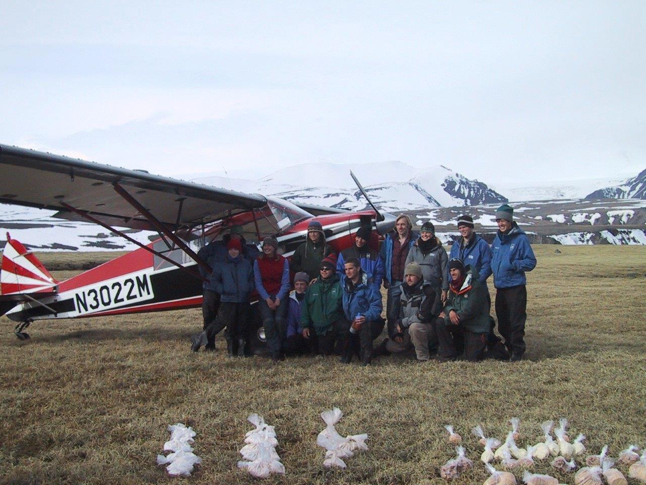
Wrangell Mountains; bush plane re-ration (Photo: Ted O’Callahan)
This is an article by invitation. The author, Ted O’Callahan, is an editor for the Yale School of Management, a freelance travel writer and an instructor with the National Outdoor Leadership School (NOLS). Here, he writes on one of his favorite places – Alaska.
All tallied, I’ve spent about 15 months on expeditions in Alaska. Most of that was working as an instructor for the National Outdoor Leadership School (NOLS). That’s a substantial investment in getting to know a place. But Alaska is too big for any person to know fully. My perspective is necessarily limited, peculiar and particular.
For starters, I didn’t know winters when if the sun is above the horizon at all, it’s only for a few hours. I’m told as long as there’s snow on the ground, doubling what light there is, the dark isn’t too bad. I’m told winters are when community really matters—human connection as a source of warmth and companionship for hunkering indoors or backcountry adventures under the aurora borealis.
Another peculiarity to my Alaska experience is that almost all of it has been in the wilderness. I’ve done little more than pass through a few of the towns. That’s in part because there aren’t that many towns. Alaska is 660,000 mi² with a total population under 750,000 (more than half of them are in and around the city of Anchorage) versus India’s 1.3 million mi² and 1.3 billion people. It’s also because I see my time in the wilderness as precious and do my best to maximize it.
In writing this piece, I want to describe four ecosystems that have meant a great deal to me. These descriptions are each postcards from places that deserve full natural histories and epic stories. While incomplete, perhaps they will encourage a few people to go explore Alaska for themselves.
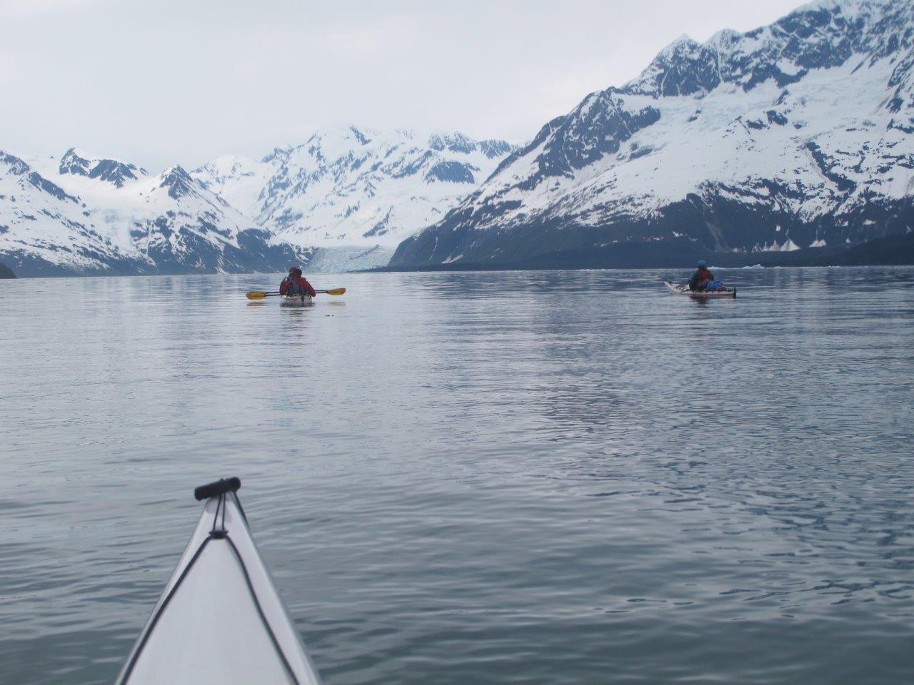
Prince William Sound; paddling to a tidewater glacier (Photo: Ted O’Callahan)
Soundings
Prince William Sound, on the south-central coast of Alaska, is ringed on three sides by glaciated peaks. It’s protected from the open Pacific by barrier islands that enclose intricate waterways, fingering fjords, bays, and coves along with reciprocal peninsulas and scattered islands. The land is steep temperate rainforest—massive conifers and blanketing moss. The water is filled with a remarkable fecundity of marine life. Whales, orcas, seals, and sea lions are regular sightings, especially for sea kayakers who accept some wetness for the extraordinary intimacy that mode of travel allows.
All four of my paddling trips in the Sound have passed through the town of Whittier which is accessed by a single-lane tunnel under the mountains. About 200 people live there, almost all in one or the other of Whittier’s two apartment buildings. It’s a micro-city squeezed onto a crescent of flat land between the peaks and the water.
There are few camping options near town, so hiring a water taxi for a lift out of the fjord is a welcome option. Unlike many other wilderness areas in Alaska, Prince William Sound is an inhabited wilderness, a working seascape. There are massive ferries, cruise liners, and cargo ships. Part of Prince William Sound’s fame is the unfortunate result of the horrendous oil spill of the Exxon Valdez tanker in 1989. On a more human scale, there are the fishing boats chasing salmon.
Fishermen aren’t allowed to sell salmon directly from their boats, but even traveling in a group of 10 or 15 people, I’ve always been given more fish than we can eat. It’s possible after so much time in the backcountry we look rough enough that they’re taking pity on the dirty beasts in tiny boats with no motors. I prefer to think the fishermen see the Sound as their home, so paddlers are treated as guests.
While those salmon feasts are extraordinary, and there’s nothing like a whale breaching just a few feet away, the tidewater glaciers that run all the way out of the mountains into the sea are sublime.
Camping nearby one, you can listen to icebergs calve off, watch the waves formed when building size blocks of ice crash into the water, and in a poorly-chosen camp be swamped by the resulting wave even miles away.
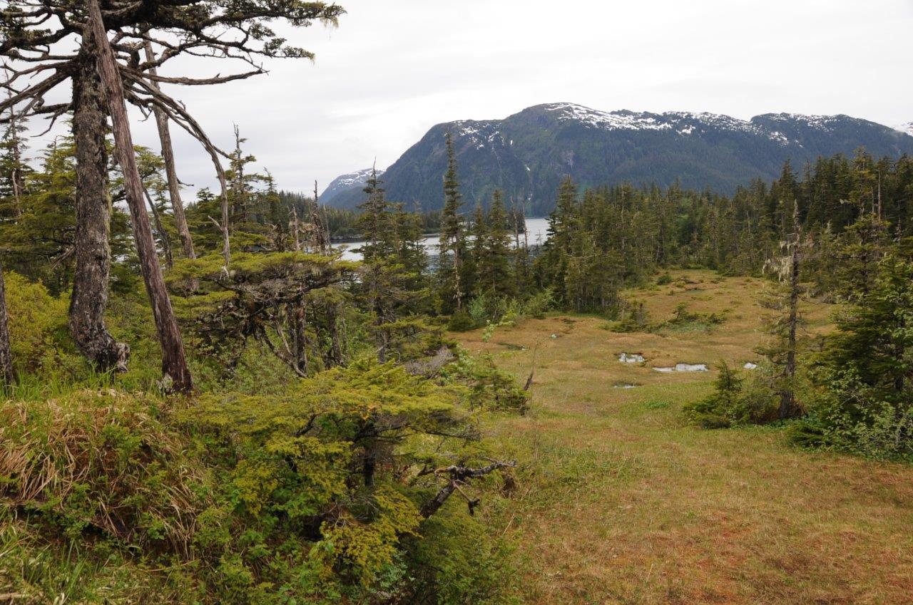
Prince William Sound; temperate rain forest (Photo: Ted O’Callahan)
Gargantuan Titanic-sinking icebergs are more typical at the poles. Alaskan glaciers throw off bergy bits, chunks anywhere from the size of a melon to the size of a truck. Once in the water the ice fizzes as it melts. The bergy bits continually change color, glowing blue, milky green, white, or clear depending on the light, water color, and proximity. The large ones are sea dragons, still until they suddenly spin with perfect exuberance.
Icy Bay has a large, active tidewater glacier. When the tide goes out, its dark sand beaches become a sculpture garden of biomorphic, intermittently-kinetic ice art. Because the mouth of the bay is narrow, it can become clogged after significant calving. This will typically clear with a change of tide or shift of the winds, but on one visit we woke to find the entire bay filled in. It was like a gigantic slushy. We couldn’t see whether our ultimate egress was also blocked, but we decided to find out. We managed to make progress by paddling single file. A double kayak took the lead with the bow paddler dedicated to pushing larger blocks of ice out of the way.
Moving through the chilly fog, with no sounds but for the fizz of melting and ice chunks thunking kayak hulls, was a pleasingly eerie adventure. The ice loosened even before we left the bay, setting us free to explore the other wonders of the Sound.
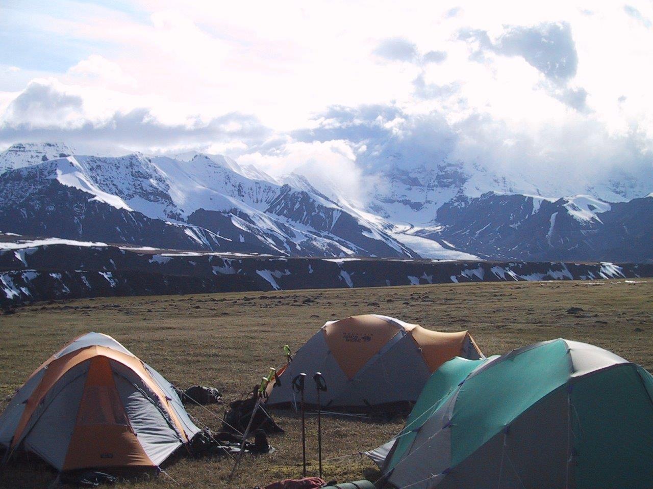
Wrangell Mountains; camped on the mesa (Photo: Ted O’Callahan)
The Alaska Factor
Most of my time in Alaska has been spent backpacking. I can’t tell you how many times I’ve been eating breakfast looking down a valley, up at a pass, or along a ridge, and realized I could see the spot I wanted to camp that night. No matter what the map told me, being able to see it meant I’d get there in no time. That may be true in some landscapes. In Alaska, it’s not. It’s an optical illusion, a psychological trick that’s all but impossible to recalibrate. That’s the Alaska factor. It lulls you with a compelling view of your route then turns seemingly manageable travel days into epics. No matter what you see, in Alaska, it’s bigger, harder, and farther than you think.
I’ve planned month-long routes in five different mountain ranges. Each range had a slightly different character, but they have a few things in common: there are no trails, the only person you are likely to see is the bush pilot flying in a re-ration, and that spot you’re so sure will just take a couple hours to reach will take all day, and that’s saying something in a place where the sun doesn’t set.
Of all the ranges I’ve visited, the Wrangells are the rawest and roughest. They will push, pull, jostle, and exhaust you. Simply walking across the tundra will be a workout because the tussocks are knee high. Outsized Alaska at it outsized best. In all areas, it’s wise to follow strict bear protocols because there are plenty of grizzly bear as well as herds of caribou, moose, wolves, eagles, and extra-large mosquitoes which are often described as the state bird.
Where many of the rivers I’ve encountered in the Himalaya are impassable without a bridge, Alaskan rivers frequently braid out across wide valley bottoms with gravel bars separating flows. It’s possible to cross massive rivers, if they are divided into many separate streams. Scouting a safe spot may take an entire day, and many experienced mountaineers view river crossings as the most dangerous part of their time in the wilderness.
Rivers are wildly variable. One year in the Wrangell’s I crossed Jacksina Creek far down valley where it had received the flow of many feeder streams. Another year I had to hike all the way to the source and even then we crossed on the glacier not in the fully-formed river that shot out of the ice.
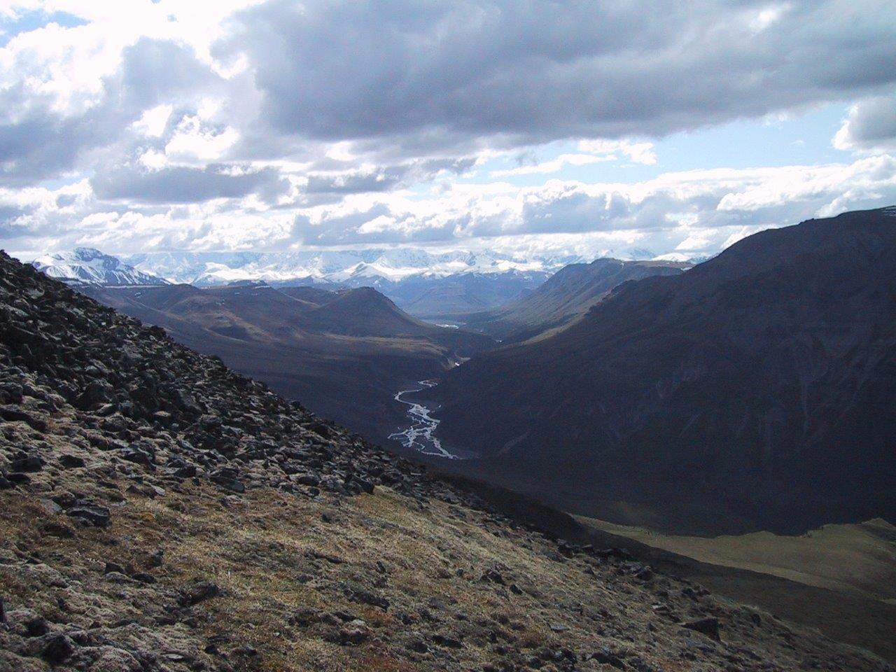
Wrangell Mountains; Jaeger Mesa and Jackson Creek (Photo: Ted O’Callahan)
Key to route planning in Alaska is a strong sense of elevation. You always need to figure out where the willow and alder end and – where the mosquitoes become tolerable? The elevations vary range to range and year to year, but it’s often enough to stay above 4000 feet.
There’s a puzzle-solver’s appeal to finding a route through a range that doesn’t dip into the lower valley floors. Staying above the willow and alder bushes minimizes the bushwacking. Down low, the brush can grow so tightly it becomes impossible to get your feet all the way to the ground. You end up sort of swim-walking on a thicket of bending trunks. Except as a pass-through to higher country, I see no reason for enduring that odd, frustrating form of travel.
So why do it at all? Immersion in wilderness so vast feels like a release into possibility, tempered or clarified by knowing that humans play a small role in that place. Plus, there are thousands of staggeringly beautiful views. From one of the plateaus in the Wrangell’s you traverse an unnamed cinder cone slope until reaching a view on a world of white. Snow-covered ridges and peaks seem like waves rising above the sea of glaciers. The ice field of mountains and interlocking glaciers spreads for hundreds of miles into Canada. It’s a view few humans have ever seen.
Inuvik to Tuk; looking north at 3 AM (Photo: Ted O’Callahan)
North to the sea
Let me start by acknowledging this trip isn’t in Alaska. It’s just east into Canada’s Northwest Territories. To my credit, I was aware of that even when I did the trip in 2005. I include it because there are north-flowing rivers feeding into the Arctic Ocean on both side of the border, and when possible, I’m inclined to focus on ecological not geopolitical boundaries.
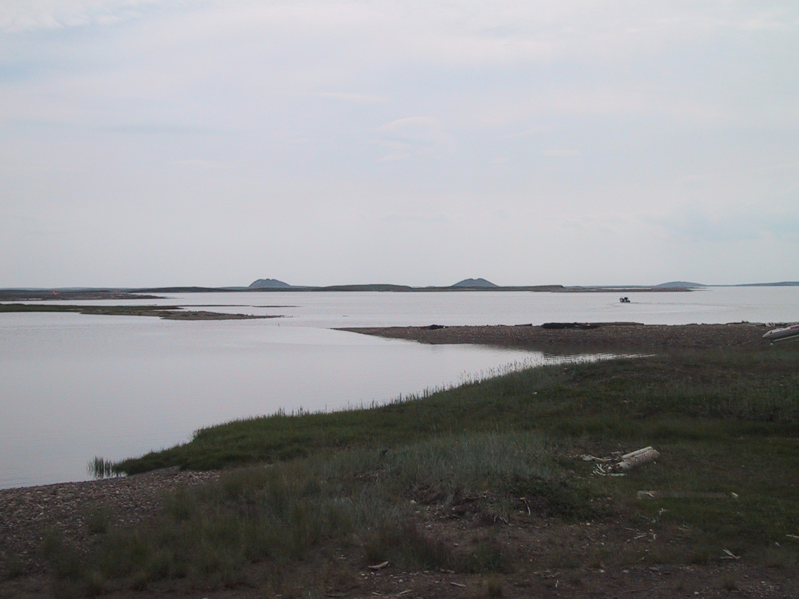
If you’re considering doing this trip yourself, pay attention now or you will miss the directions. From the town of Inuvik, put your kayak in the Mackenzie River. Paddle downstream until you reach the ocean. Turn right. Continue paddling until you see a village. That’s Tuktoyaktuk. You can’t miss it; it’s next to three pingoes.
The navigation challenge isn’t the draw; the unique landscape is. Pingos are an Arctic oddity. Ultimately, they are nothing more than hills and rarely taller than 150 feet. Quirks of the freeze-thaw cycle occurring on top of permafrost can create these eruptions of ice covered by a thin skin of soil and vegetation. But the tundra is so flat these bumps are the highest points and serve as navigational aids from the land, water, or air.
Seen from above, the ragged northern edge of the continent is lacy terrain, thousands of square miles of boggy water-pocked tundra. It’s impossible to know if there’s more land or more water. In a kayak on the river, the flat of the land turns the attention to the sky which seems bigger than it ought to be, as if someone has pulled the horizon down several degrees, as if you are viewing it through a fish-eye lens. You feel like a drop of water about to fall off the top of the world.
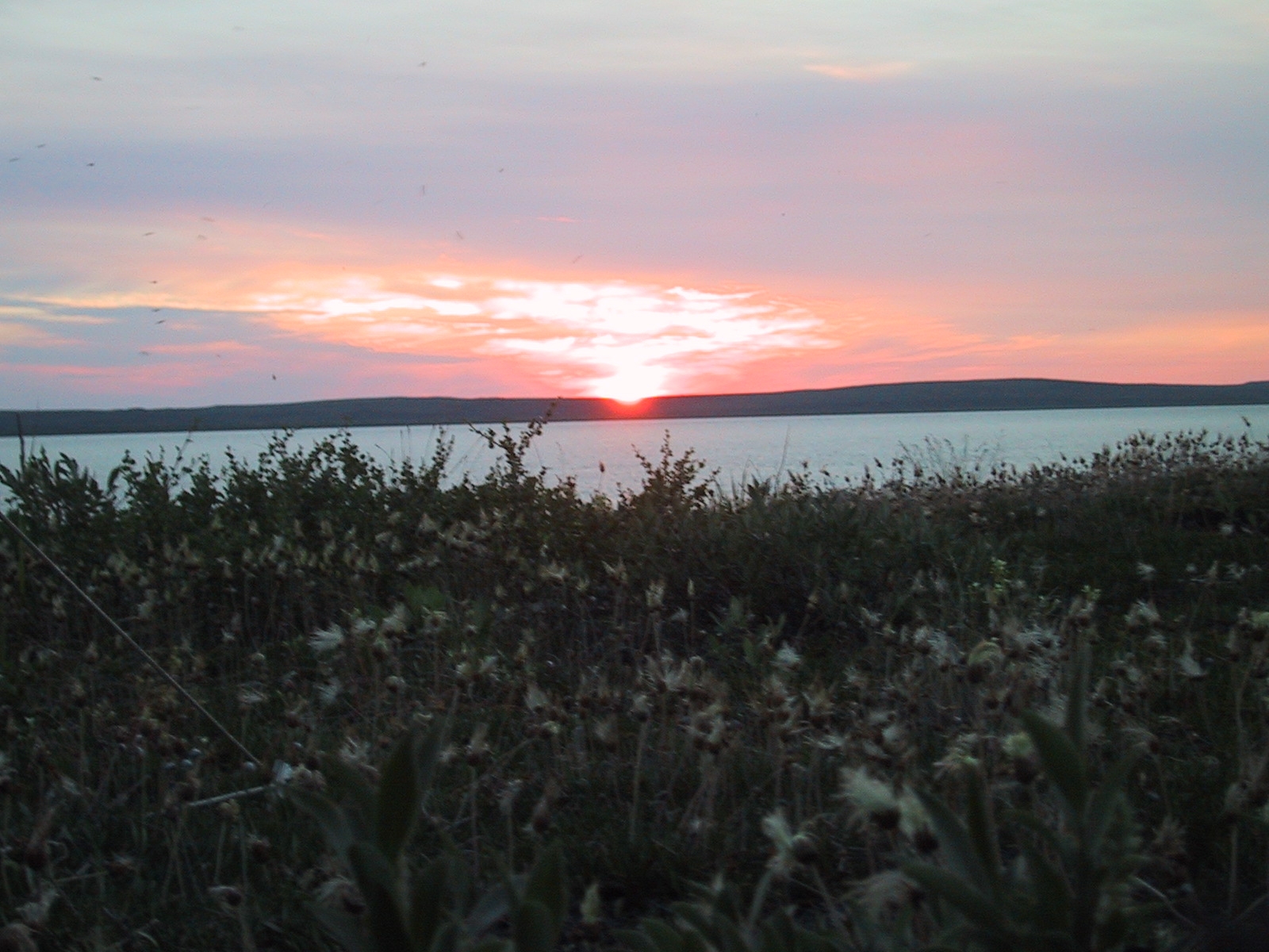
There’s a hypnogogic quality to travel in the far north, a dizzying dreaminess that perhaps comes from the summer sun spinning round and round in the sky. It never gets far above the horizon but neither does it set. It just scribes a low circle. The day seems to move slower. I loved the astronomical oddity of seeing the sun due north. It had been above the horizon for weeks before I arrived and would stay there for weeks after I left; a celestial marathon. The inverse—ceaseless night—occurs in winter when the sun gives the sky to the moon and the silent fireworks of the northern lights.
Inuvik to Tuk; view of pingos (Photo: Ted O’Callahan)
But, however compelling the heavens, it’s wise to pay attention to the land too because, it’s possible to encounter either grizzly or polar bears. Humans are definitely not the top of the food chain. A friend had paddled a similar route in mid-summer and was hit with a snowstorm. Yet, I paddled in shirt-sleeves, as long as there was a breeze, otherwise even some distance from shore the mosquitoes were unbearable—orders of magnitude worse than other parts of Alaska.
I’ve been told the Arctic’s flies and mosquitoes can drive caribou mad; it seems entirely plausible to me. I tried to be either on the water paddling or in the tent. Cooking was a frantic affair done in the windiest spot available and with multiple mosquito coils burning.
When I arrived in Tuktoyaktuk, the First Nation residents were finishing up a traditional hunt for beluga whales. The inhabitants of the first house I came to invited me in. The kids were eating breakfast—boiled whale with ketchup followed by a bowl of cereal.
When I asked how often they saw polar bear, the mom said one had come into town the previous winter. She said the bear knew a woman in the village who had died. It walked through town to the dead woman’s house, paused to pay its respects and then quietly left. I think my host was entirely serious, simply describing the world as she knew it. It’s possible she was checking to see if I was gullible. I’m still not sure which because it’s a place where anything seems possible.
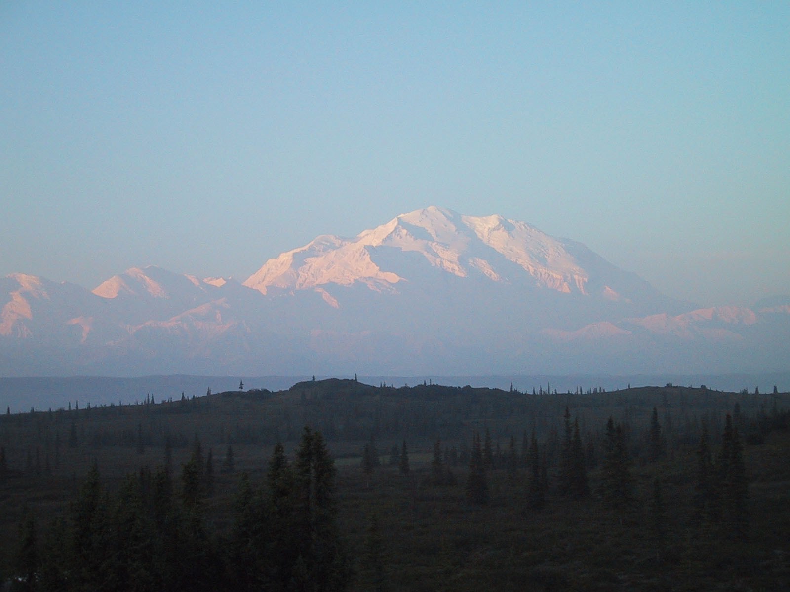
Denali; view of Muldrow Glacier (Photo: Ted O’Callahan)
Denali
As should be familiar by now, first the caveats. I didn’t summit Denali, but in my view, I did climb it. To explain the distinction, my goal is to spend time in beautiful places. That makes me a mediocre mountaineer. This shows up in my low percentage of peaks reached versus peaks attempted. It also shows up in my tendency to select climbs with long approaches, significant time on the mountain, and limited technical demands.
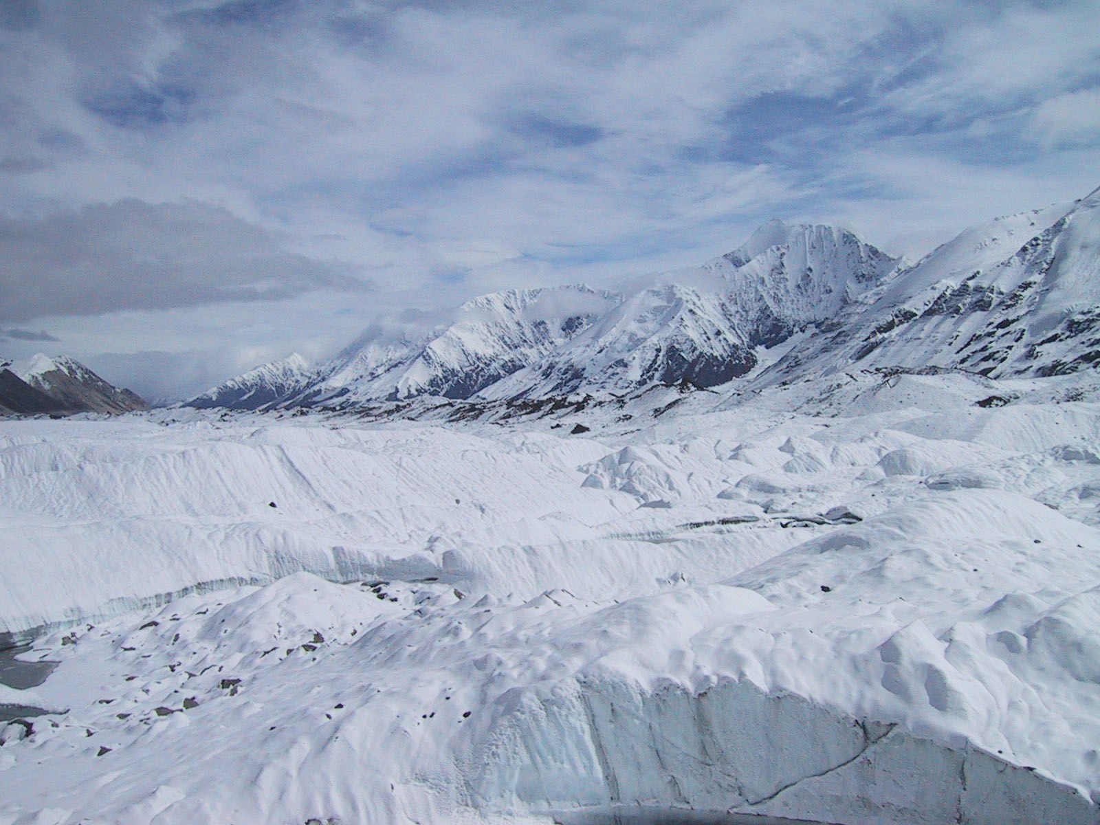
In 1997, with a group of friends, I spent a month climbing Denali. At 20,320 feet, Denali wouldn’t be noteworthy in the Himalayas. But it’s the highest mountain in North America and because it climbs out of a plain, it’s also arguably, the tallest mountain in the world. Wonder Lake, where we started, is at an elevation of 1985 feet, meaning the ascent from base to summit is over 18,000 feet which is a larger vertical than much larger peaks.
From Wonder Lake, climbers typically take the Muldrow Route which was established by the first successful summiting of the mountain in 1913. It’s the least technical and slowest option for climbing the mountain. These days most people prefer to use the other side of Denali which lets them fly to a base camp at 7200 feet for faster climbs along the West Buttress.
Unquestionably, I’m impressed by the skills and drive of those who manage focused three- or four-day scramble to the top of Denali, let alone the 12-hour record for a speed ascent. It’s astounding. It’s also another species of activity from what I do. I gladly acknowledge I’ve fallen out the bottom of the mountaineering hierarchy, but I do spend time in the mountains in a way that matches my preferences and abilities.
The approach to the Muldrow involved a 20-mile hike over tundra and a crossing of the icy and massively-braided McKinley River. After crossing through McGonagall Pass, we were in a world of snow, rock, and ice. We’d sent our rations ahead months earlier to be cached by a dog-sledder. That’s the only way we could spend so much time on the mountain. Even so, much of our time was spent shuttling loads of food.
Early on, one member of the team got sick and eventually needed to be evacuated. While four of the original six-member team continued on, the days we’d expected to use to acclimatize to the altitude were used up before we got high.
It’s hard to understand the impact of altitude even on those who aren’t experiencing acute symptoms. I remember taking 15 minutes to put on my plastic boots. I hadn’t noticed the slowness except for the fact of my watch speeding ahead.
From the head of the Muldrow Glacier where there’s a gorgeous knife-edge ridge that offers access to the high country of the Harper Glacier. The upper section is harsh and austere. We moved without acclimatizing rest days to a high camp around 17,000 feet. That left us a single day to try for the summit. The day was clear if brutally cold. Three of us trudged up and off the Harper to the ridge that splits for the north and south summits.
I was so oxygen-deprived that when I had on my fleece face mask, I panicked because it seemed to hinder my breathing. I’d rip it off then my face would get scarily cold and I’d put it back on. This cycle repeated for hours.
When we reached the Football Field, a flat section leading to the summit ridge, two of us stopped knowing we were moving so slowly it would take us many, many hours to ascend the final 600 feet of elevation to the summit. We gave our third an hour to go on.
It was remarkable to look down at the peaks of the Alaska Range poking out of a cotton blanket of clouds more than a mile below us. Standing still, I could wear my face mask, and I felt strong. Each time I tried to walk all the effects of altitude return within a few steps. While our third was dealing with the altitude much better than we were, he realized even for him it would be a slow climb and we’d judiciously decided to descend together.
I wish we’d had the simplicity of completion. And that view from the tippity-top, is always what I miss when I don’t reach a peak. But I love the shaggy, gorgeous splendor of the expedition that actually happened.
Our descent to the Muldrow was a four-day gorging on gravity and the last of our rations. My hips were rubbed raw from wearing a backpack for so many hours of tromping every day. We had left a cache of extra rations on the lower glacier for our hike out. We were out of food when, within ¼ mile of the bamboo wands marking our buried plastic buckets of food, the sun turned the snow into a slush bog.
Under the snow was crevasse-wracked glacier, so we had to be roped up, but being tied together meant that with each step there was four-times the likelihood that someone would sink to the ankle, knee, or hip. When that happened, we all stopped.
Denali; view of summit from Wonder Lake (Photo: Ted O’Callahan)
We’d spent a month on the mountain hauling huge packs in freezing conditions. We’d spent a week at altitude high enough that we had no appetite. Now that we were down low again, our bodies were screaming for the debt of deferred calories to be paid. And it was implausibly hot for a glacier, for Alaska. The sun got a little hotter, the snow got a little mushier and our food got a little further away, at least in time if not distance.
It should have taken us three minutes. Instead for the next three hours someone was constantly post-holing, wiggling out of the backpack in order to be light enough to stand, hauling the pack on and in so doing sinking again. Sometimes all four of us were simultaneously struggling to stand. It would have made for a hilariously pathetic film. Eventually our absurdist ordeal ended. We reached the food, then gorged and gorged and gorged.
A few hours later we stepped off the Muldrow Glacier onto the moraine. Typically, such a landscape reminds me of a mining operation—grinding rock at a scale beyond what humans can manage. But after weeks on the ice, like sailors returning to land, in soil that was little more than powdered stone, there were a few stunted flowers. Their stems were covered by hairs, an adaptation to the hostile environment. They were unlovely, by normal flower standards, but they are still among the most delicate and sweet-smelling things I’ve ever encountered.
Final Words
Whether hiking, mountaineering or paddling, whether above the Arctic Circle or in the comparative tropics of Prince William Sound, Alaska is a marvel that rewards efforts to get to know it. In reviewing my time in Alaska to write this, I was struck with gratitude for all that I’ve had the opportunity to see and hunger to see still more of Alaska.
(The author, Ted O’Callahan, lives outside of Washington, DC. He is an editor for the Yale School of Management, a freelance travel writer, and an instructor for the National Outdoors Leadership School [NOLS]. He has led hiking, mountaineering, and sea kayaking expeditions for NOLS since 1997. Between work and personal trips, he has explored Alaska, Patagonia, British Columbia, Mexico, Ecuador, Spain, India, Nepal, and Scandinavia. He is forever seeking to balance the draws of home, new places, and old favorites. For additional information and other writing, see www.tedocallahan.com.)
