

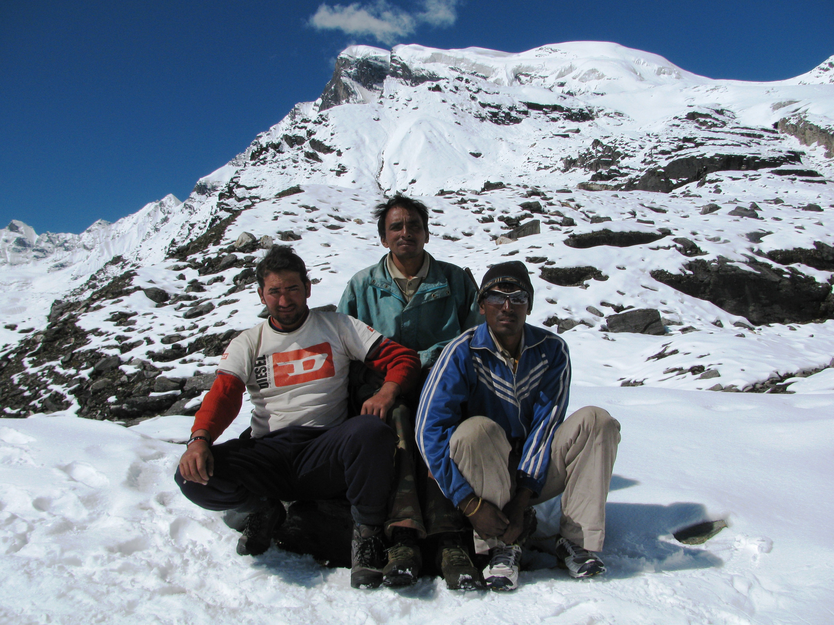
Prem Singh (bottom right, on dry grass) and the mountains (Photo: Shyam G Menon)
Prem Singh was puzzled.
It was a bright day.
He had returned to Camp 1 on schedule to celebrate the conquest of an “ easy’’ 19,500 ft-high peak.
We were four men.
Of that, the three who set out to reach the summit of Baljuri had retreated.
“ How can that be?’’ Prem Singh asked.
I explained to him that weather hadn’t favored us; that I wasn’t the tough mountaineer he thought I was. He loaded his rucksack with some of our equipment and hastened towards Base Camp, probably finding solace in the distraction of a fast hike. When I saw him again, Prem Singh was resting on a distant hill side; a tiny figure against the vastness of the Himalaya. He was still a picture of inquiry; bothersome question in mind, gaze fixed to the sky. I knew nothing I said would alter his perception, assuage his disappointment in me or this expedition he got aligned with. I quietly took out my camera and clicked a photo of Prem Singh resting. It seemed the best thing to do.
“ Can you suggest a peak that someone of my ability can attempt?’’ I asked.
We were sipping tea at the Rupin Pass. Ravi Kumar, who was the stronger climber, hatched a plan. We could have an expedition in which, he attempted the technically demanding Panwali Dwar and I tried its neighbor, Baljuri. Years ago, Ravi, who worked as an outdoor educator, had climbed Kamet (25,446 ft) and Mamostang Kangri (24,659 ft). After the Rupin Pass trek, he moved to a new job as director of an outdoor school in Ranikhet. Amid changed priorities, Panwali Dwar took a back seat. I continued, a low paid freelance writer, past forty and hauling mid life crisis to the top of Stok Kangri (20,187 ft) in Ladakh. That happened in July 2009 (for more on the Stok Kangri trip please try this link: https://shyamgopan.wordpress.com/2014/12/23/twenty-thousand-feet/). In the flush of that success, Baljuri seemed doable. After all, it is nearly 700 ft lower in height than Stok Kangri – so the idiot in me reasoned. Having neither much money in the bank nor the advantage of strong currency, which foreigners and NRIs enjoy in India, Himalayan expeditions are expensive for me. At the same time, I didn’t want to ask my mountaineering club for help. I found that my friend Prashant was looking to take a break from work in Mumbai. He had less than three weeks leave overall and his last mountaineering expedition had been seven years earlier, a trip to attempt a peak in Zanskar that I had also been part of. We debated if our wish was mountaineering or a high altitude trek. The former is expensive and unforgiving of poor preparation. The drift however was towards attempting a peak. Whoever said mountaineering is a bug got it right.

Khati in 2009 (Photo: Shyam G Menon)
We headed for Delhi and from there to Ranikhet and Bageshwar. “ This is a famous hotel, known even in Delhi,’’ the waiter said as we sat down for lunch at Bageshwar. The hotel was called King Kong da Dhaba (King Kong’s dhaba; dhaba is a small eatery), the name in question not a reference to Hollywood’s monster of a gorilla but the late Hungarian wrestler Emile Czaja, who became well known in India for his bouts with Indian wrestling great Dara Singh and went by the ring name: King Kong. From Bageshwar, where we also picked up Narayan Singh Dhanu, it was a couple of hours drive to Song. An hour’s walk brought us to Loharkhet the first halt on the busy trail to Pindari Glacier. If I remember correct, it was September 2009, technically the end of monsoon but as I would discover through stories done a year or two later, Kumaon had been witnessing a shift in the timing of heavy rainfall.
The trail to Pindari is an enjoyable hike and because it falls in the category of relatively easy hikes, it is frequented by many. However rains in these parts can be heavy (in the years between 2009 when the expedition of this story happened and 2015, several rain induced changes to trekking route have occurred in the Pindar valley). It is dynamic terrain. While we were in Ranikhet (we spent a couple of days there putting together food and equipment), it started raining. We reached Song and Loharkhet; it was still raining. Next day we hiked out from Loharkhet in the cold mountain rain and with no accommodation available at Dhakuri, marched all the way to Khati. We were now roughly midway to the glacier. It rained heavily through the night and into the morning. Khati was quiet. Amid the downpour, the only sign of social life was the local tea shop. We took a room close by and hung around the tea shop. News came of landslides scarring the trail ahead and bridges washed away by furious mountain streams. In the distance, the roaring Pindar River was a constant drone. Tourists retreated. Mule traffic stopped. For hours, porters, muleteers and mountain guides sat holed up in the local tea shop, discussing difficulties on the path ahead. Fueling it was the absence of people on the trail to Khati from the glacier. That half had run cold.
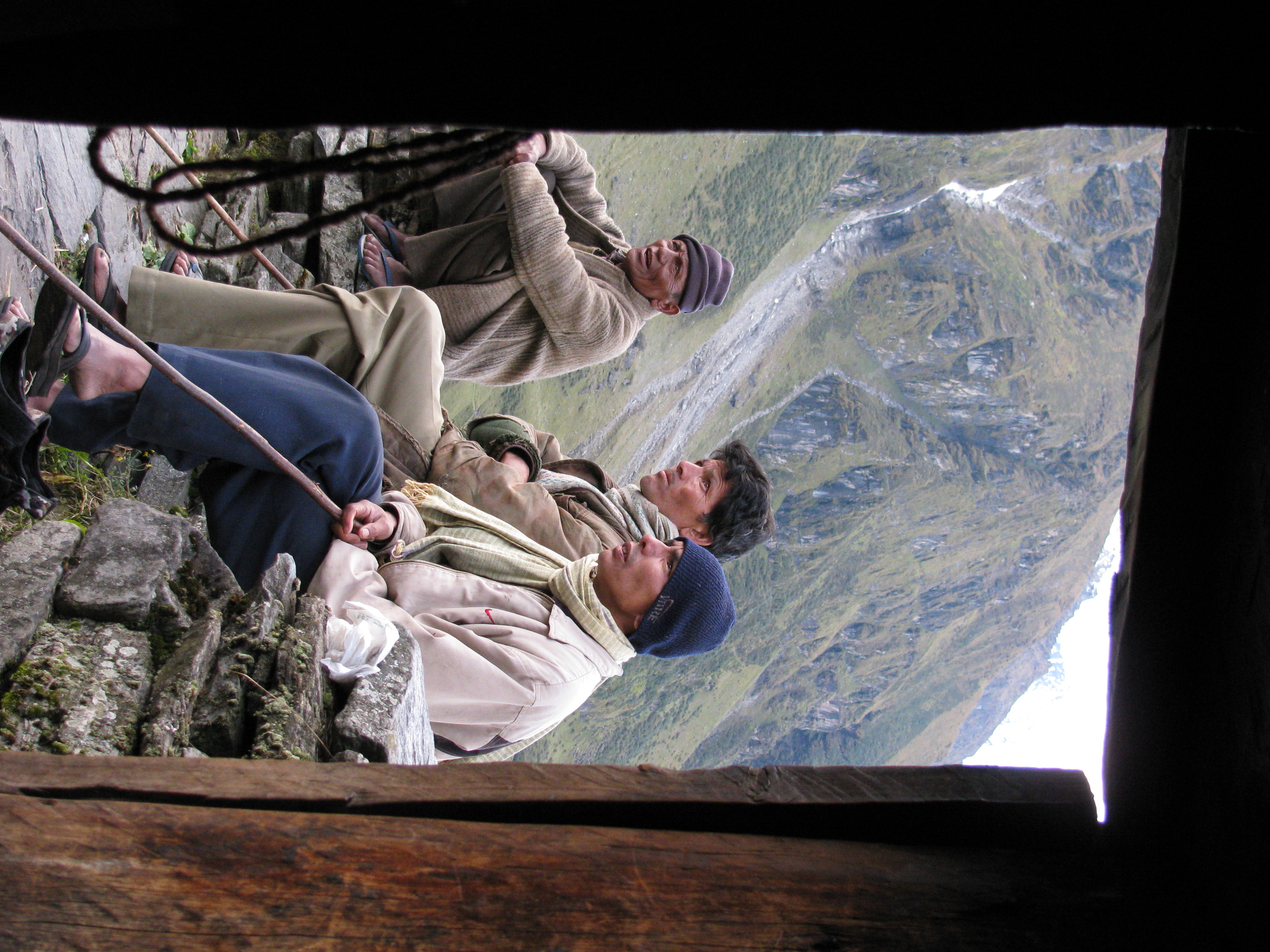
From left: Jeetu, Prem Singh and Narayan (Photo: Shyam G Menon)
Bored, we joined those gathered around a fire at the tea shop. Given the rain induced-shutdown, people smoked, played cards; those into gambling sat separately in a closed room from where periodically shouts and arguments erupted. All the talk was about gloom. We waited two to three days. In that time, some hiking teams stuck here and there on the route, managed to return. Crucially, two new ones turned up – a team of hikers from the Indian Air Force (IAF) and a team of American students from the school managed by Ravi Kumar. Then two shepherds walked in from the glacier side with details of the ravaged route. Bit by bit the mood altered. From speculating wildly, Khati graduated to having information and new teams that had energy. From talk of gloom and doom the chatter at the tea shop shifted to jokes and optimism.
It was still raining when we left Khati, large IAF contingent up front, our small team in the middle, the Americans behind – enough humans to bulldoze the trail back into shape. At every snapped portion PWD workers, hikers and villagers worked together to push rocks and logs into place. Footstep after footstep slowly stabilized the path. We were strong hikers, decent at hauling load. By early evening, we were having tea with the hermit who stays at Zero Point (as the Pindari Glacier area is called); late evening we were at Base Camp, a shepherds’ dhera or stone hut. It was a lovely place. This was also the first of several mistakes on this expedition. Having lost days to rain and with the climbing window narrowed, we had walked straight from Khati to Zero Point in one day. That was elevation gain ideally done in stages. Neither the IAF team nor the team from the outdoor school rushed up. They took it slow.
Three people anchored my team. Every time I worked with Jeetender Singh Rawat (Jeetu) on a high altitude trek or wilderness camp, I had enjoyed the team work. He was a good friend to have in the mountains. At my request, Jeetu had come from Uttarkashi to oversee the team’s food. He was a Garhwali on his first expedition in Kumaon. Narayan was among Khati’s best known mountain guides then (he has since become a businessman living in Bageshwar) for climbs in the Pindari region. He had climbed Baljuri before. If Jeetu was the hardy outdoor type seeing wilderness first and climbing second, Narayan’s approach was just the opposite; at that time he was all about bagging peaks and passes. The two got along well. We needed a man at Base Camp who could range between there and higher camps – enter Prem Singh, Narayan’s brother. It was a good, compact team.
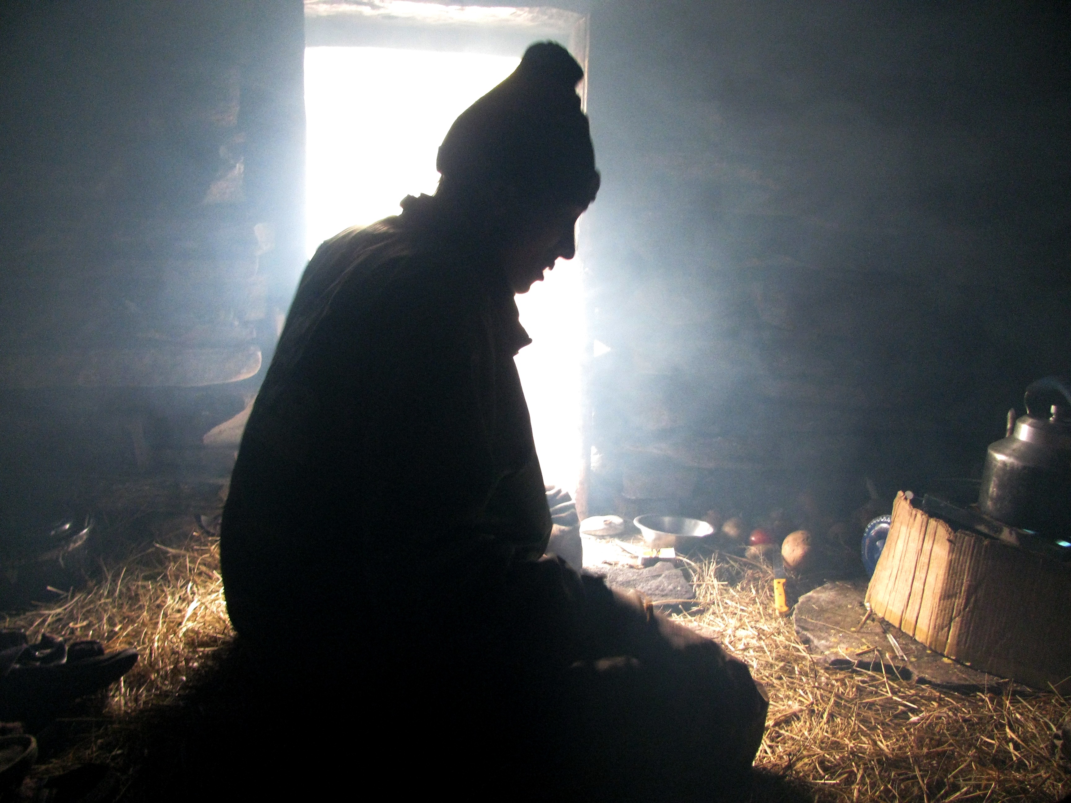
Prem Singh at the dhera, our Base Camp (Photo: Shyam G Menon)
We were camped across the Pindar River, opposite the hermit’s ashram, glaciers in sight, everything in the lap of an impressive arc of peaks. Two things qualified the area – it was historically important and the mountains were close, dominating by sheer bulk. Right behind the dhera, occasionally visible above the immediate ridge was Baljuri. Its summit sloped to a shared link with the steep pyramid of Panwali Dwar (21,988 ft), which in turn led on to Nanda Khat (21,816 ft). The presiding peak of the area, if there was one, would be Changuch (20,863 ft), bang in the middle of the arc. Next to it, on the same base, stood Nanda Kot (22,641 ft). In the corner between Nanda Khat and Changuch was Trail’s Pass. Between Nanda Kot and the mountain guarding the hermit’s ashram was the route to Laspa Dhura (19,513 ft). If you gained elevation on the nearby slopes you could see the twin peaks of Nanda Devi (25,643 ft) behind this immediate rim of peaks. Of these Panwali Dwar and Nanda Khat are described as being on the protective wall of the Nanda Devi Sanctuary. To that extent Baljuri, which has a common col with Panwali Dwar, may also be seen as part of it. Nanda Kot was outside the wall.
Peak climbing is done in stages, splitting the route into a series of high camps. Each camp has to be stocked; so you carry up all that is needed, the haul being most severe in the first stage and depleting in weight – albeit rising in strain due to altitude – from there on. Besides the core stocking role, these load ferries serve another purpose. They help you acclimatize. Staying active through work is the best way to acclimatize and the recommended model is to work high and sleep low or open a high camp but return to the altitude you left, to sleep. We were in the classic jam that visits Indian expeditions. The travel to the mountains, putting together final provisions and gear, the heavy rain – all had eaten up days. If you love the mountains, then you would hate the Indian predicament. We rush in to altitude and rush out, expecting to climb a peak in the same clockwork style of a Mumbai rat race. One rain, snow storm or landslide and the schedule is upset. Ideally, you should come with time on your hands. This helps you acclimatize and work around problems instead of forcing an attack-or-retreat scenario on every hurdle encountered.
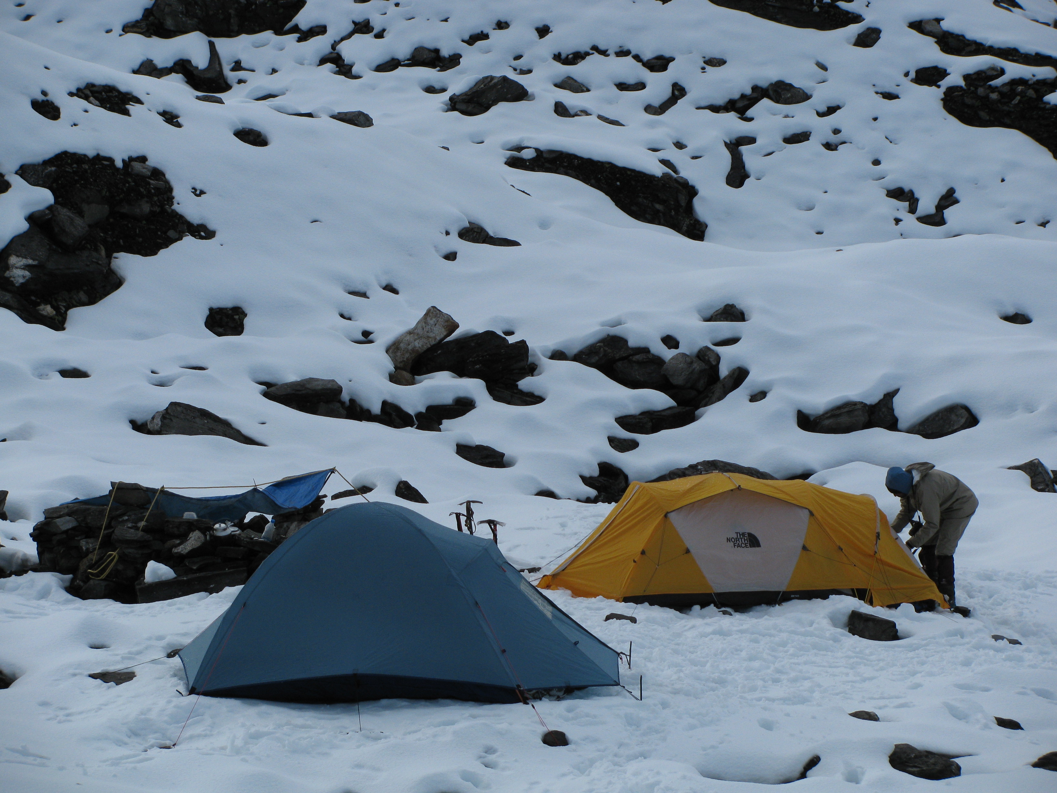
Camp 1 (Photo: Shyam G Menon)
The hermit reminded us of the folly in not having at least one rest day at altitude. Swami Dharmanand Giri was an interesting person. He lived alone in that wilderness and was a name known to trekkers and mountaineers frequenting the region. At his own pace, the hermit had done much walking around in the Himalaya. One such high excursion periodically undertaken lay right behind his ashram. On the high route to the Kafni Glacier (not to be confused with the popular lower one from Dwali), at an altitude another thousand feet or more from his ashram, he kept a small prayer hut. The advice of such a man on the need to rest and recover was not to be ignored.
The best we could do for rest, given the limited days at our disposal, was open Camp 1 and return to Base Camp early enough to rest the remaining part of the day. However, on the first day of the climb, the long haul with load to Camp 1 proved tiring for some. We were forced to dump the load at a midway point and retreat to Base Camp in bad weather. That rain was still very much around. The next day we just about made it to Camp 1. It was snowing. Kitchen was under a small tarpaulin sheet tied to a pile of stones and trekking poles. Jeetu crouched under it making tea. The MSR stove – designed to be multi-fuel – choked periodically on Indian kerosene. Amid this, a huge blob of dense, white cloud enveloped the camp. Below in the valley, like roots for this giant cloud straddling everything around, black clouds sprouted; they resembled those spirits from a Harry Potter movie. I feared we were heading for serious trouble. But it merely kept snowing. By night two people were down with headache. Altitude sickness can affect anyone. Jeetu, one of the affected, was uncomfortable, lacking appetite and feeling nauseated. We decided that if he didn’t recover by morning he would go down to Base Camp. Prem Singh having helped with the load ferry had already gone back promising to return the day after, by when, he estimated, the peak should be in the bag. Was Baljuri’s claimed easy peak-reputation, a load in my backpack? I wonder. This I will say – when you are on a peak, what others said of it is immaterial; there is only what you experience.
Our medical kit was well equipped. Its contents included medicines for altitude sickness, which can become a serious condition. High altitude sickness is not something I feel confident to tackle for the simple reason that patients can mix it up with ego; they may deny the existence of a condition for fear that it will jeopardize one’s chances of attempting the summit. You can notice symptoms even if a patient is in denial mode but steps thereon require you to be assertive. Next day nobody complained of headache. We seemed fine. All the same I began the day highlighting the importance of honest admission as best precaution for altitude sickness. I was leader but thoroughly lacked the assertiveness to ground anybody. That’s a flaw in my leadership style. I hate assertiveness because although it may serve an immediate purpose, a whole world trained to lead assertively is one noisy place to be in. It is a zero sum game unless you are in the business of selling loudspeakers or are happy following the loudest. Even if I tried being assertive on the mountain, I wouldn’t succeed because at some point every achievable summit plays games with the climber’s ego and in India, certainly the male ego. Knowing how much success defines you in rat race, you want the top. So who will admit weakness without argument? We want the one shot we have, to deliver everything. In my eyes, Jeetu showed courage and excellent conduct by letting others know his condition.

The huge cloud approaching Camp 1 (Photo: Shyam G Menon)
The two routes – from Base Camp to Camp 1 and from Camp 1 to Camp 2 – were poles apart. The first route had been long with snow only toward the end. Its biggest challenge had been a stiff mountain face, where the going was over clumps of long grass. It could easily take a man’s weight near the root but step on the blades by mistake and off you slipped. The second route was less inclined on the whole but the snow cover ranged from ankle deep to knee deep. At a few places it was thigh deep for me and I had to lift my leg with my hands and keep it in the next hole excavated by the person ahead. It was laborious plodding. We were almost at Camp 2 when bad weather struck. It snowed reducing visibility. Eventually we struck camp toward the Panwali Dwar side but adequately off that mountain to escape its avalanches. Courtesy the prevailing weather, the steeper Panwali Dwar was sending down avalanches. Using ice axes we prepared a level ground on snow to camp. The last man arrived just as the tent went up. To save weight, we had brought only one tent up to Camp 2. It was a big mistake partly fueled by this ever present notion that we would climb Baljuri and be back in a jiffy.
That evening a few things worked, many didn’t. What worked well was the sight of Jeetu back in action and my stove. Jeetu in good spirits is contagious energy. We had carried unleaded petrol as fuel for higher camps. Powered by a new fuel bottle containing unleaded petrol the MSR stove hummed melting snow for drinking and cooking (I now use only petrol – unleaded if possible – as fuel for the stove). What didn’t work was team morale. The exhausted, looked dazed and disinterested. To top it, I had blundered hauling up just one tent. Before any summit day, rest is crucial. My tent could take two large people or three normal people. We were three big people and one small person. While tents do warm up with human presence they gather condensation from within. Most tents handle this well at design capacity but when overloaded you can’t blame a tent for harvesting moisture. I was at the side, where this harvested moisture aggregated. I was cold, my sleeping bag was wet and I was unable to get the others to yield dry space. For a while I sat and slept. I spent the rest of the night either curled up in a ball or up sitting. That was when I first sensed the expedition had failed. I distracted myself `dusting’ the tent (shaking the tent fabric) so that the snow accumulating on top slid off without weighing down and damaging our shelter. It kept snowing.
At 4 AM, three of us left for the summit. It was cold; the terrain, white. We plodded on. The shared ridge of Baljuri and Panwali Dwar seemed very reachable. Once you get to that ridge, it is a long plod on snow to the summit; a concern probably being the true nature of the other side of the ridge, which you don’t see from Pindari. Seen from Sundardhunga – the valley beyond the ridge – this `other side’ is rather steep. This was my estimation. You don’t fully know features on a mountain till you are actually up there. At about 5.15 AM, following a short, steep climb Narayan who was leading the way halted. We were on a ramp at the base of the slope leading to the shared ridge. The ramp was progressively cantilevering. Beneath was a large hole, a big pool of ice water. In the light of our headlamps, it seemed to stretch from the side wall of Baljuri to the side wall of Panwali Dwar. Narayan was taken aback at what he deemed changes to familiar route. The only way out from this obstacle lay to the Panwali Dwar side, probably going up that mountain a bit and skirting the pool to access the shared ridge beyond. “ This isn’t how it used to be,’’ Narayan said.
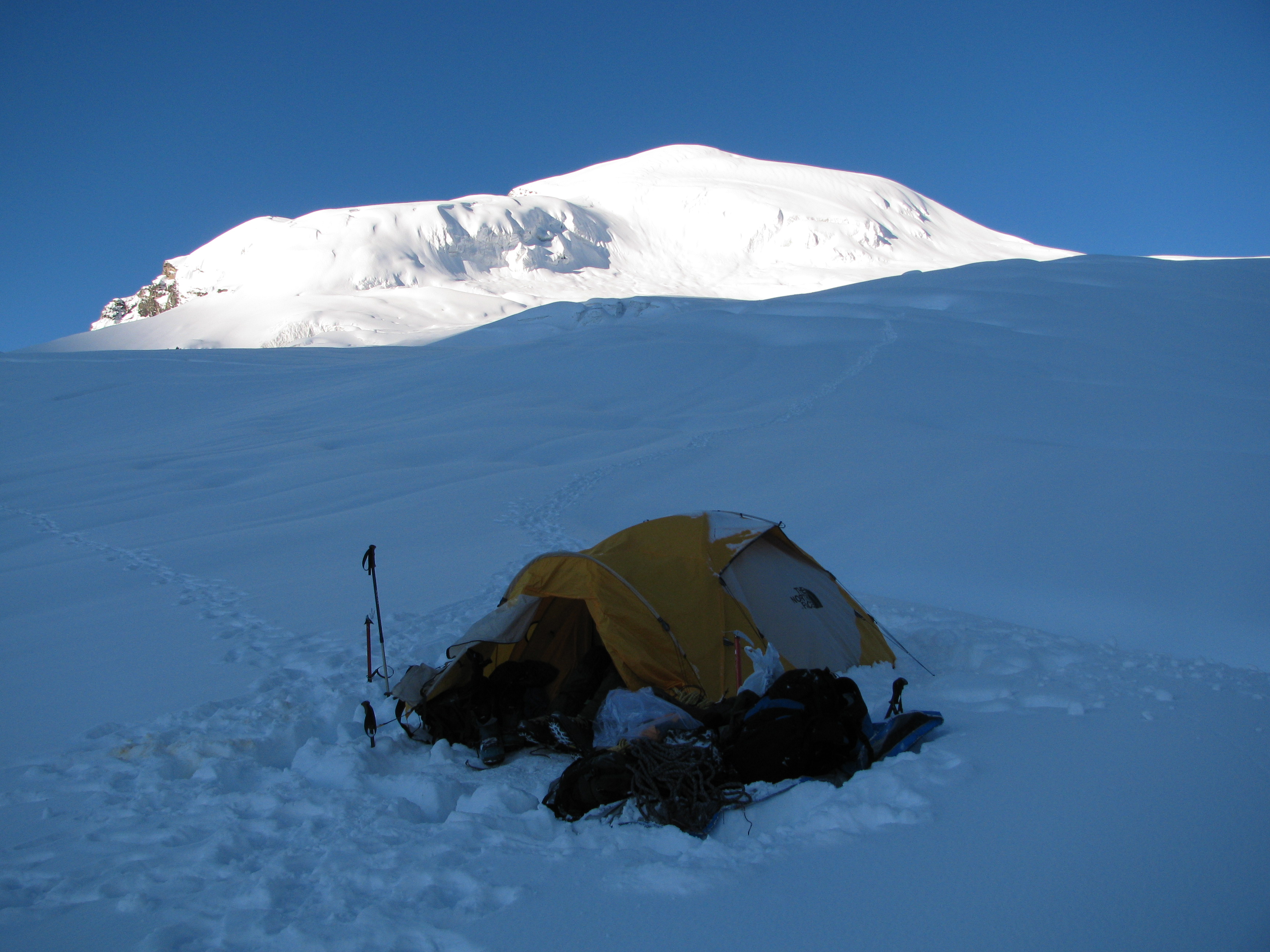
Camp 2, just before it was taken down (Photo: Shyam G Menon)
We made an assessment and agreed on two constraints – first, there was only so much we could see with headlamps. We could find an alternative route once there was more natural light. That meant one day to explore, another to attempt the summit. Second, Panwali Dwar had been sending off avalanches (mostly small ones, sort of resembling how you would dust the snow off your jacket after a storm) and snow condition nowhere on that mountain, recommended exploration. What we needed to do was – give the mountain enough time to settle itself. What we did not have as a team was exactly those additional days. Not only had we lost days in the walk-in, it also sapped some of the initial momentum. We were tired. We didn’t want to endure the wilting morale either; I was sure I didn’t want to repeat a night like the one just past. Both Narayan and Jeetu looked at me. “ Let’s call it off,’’ I said. We stood there for some time looking at the summit, so achievable had it been a different set of circumstances. We broke camp and headed down the mountain. It was a fine day, the first one with confident sunshine in a long while.
At Camp 1, we met Prem Singh. His broad smile anticipating news of success gave way to puzzlement over how the summit evaded us. Back at Base Camp, shepherds dropped by for conversation and tea. They had lost one sheep after it slipped and fell into the rapids of the nearby river. Recovered quickly but too late for life, the dead animal was now mutton warming the shepherds’ evening. Prem Singh decided that we deserved to eat well. He went over to the shepherds’ and returned with a portion of meat. Jeetu joined him to cook the mutton. On the way back, at Dwali, Prashant and I took photos. Battered by rain, cold and strain, we looked beat. In the outdoors, that plight is life restored to simplicity; it is a `reboot’ with all the cookies and viruses that clogged the system, removed. You feel happy. A month or so later in Mumbai, I received a call from Narayan. He said he had reached the top of Baljuri yet again, this time with a team from West Bengal. “ I still don’t understand what happened to us. Why didn’t it work for us?’’ he wondered.
Shepherds gathered for a chat at the dhera (Photo: Shyam G Menon)
Not long after that phone call, I met Krishnan Kutty, who, like Ravi Kumar, ran an outdoor education facility. He had been on Baljuri before and I had mailed him for route details ahead of the expedition. Kutty had emphasized the need for time and patient acclimatization, both of which, we flouted. I apprised him of the failed expedition. He listened carefully and then said, “ It appears to me, you turned back at the bergschrund.’’ That is the technical term for the point where a mountain’s glacier breaks off from the stagnant ice of its higher slopes. It typically manifests as a big crevasse. Crossing a bergschrund or finding a way around one is routine for mountaineering expeditions.
In September 2009, before leaving the Pindari Glacier region, I went to meet the hermit. Used to waking up early in the morning, he said that on the day of our summit attempt he had seen tiny dots of light heading up the glacier for the common ridge linking Baljuri and Panwali Dwar. It made me happy. That was a nice picture; usually found in accounts of mountaineering – the classic summit push under headlamps in the darkness of a mountain slope. It felt nice to know that I had been in one such picture.
(The author, Shyam G Menon, is a freelance journalist based in Mumbai.)
